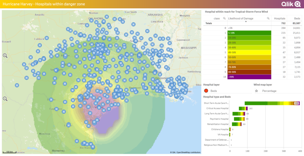
When it comes to adding geographical context to your data analysis, Qlik Sense stands out with its robust GeoAnalytics feature. Qlik GeoAnalytics not only provides comprehensive mapping capabilities but also allows for location-related data analysis and decision-making. This powerful tool brings an entirely new dimension to your data, enabling you to unearth geographic-based insights that might not have been previously evident.
Introduction to Qlik GeoAnalytics
Qlik GeoAnalytics, included in Qlik Sense Enterprise, is designed to help users visualize and analyze location and geo-spatial data. It supplements your traditional data with geographic context, providing deeper insights and understanding of your data patterns. Whether you want to display distribution networks, understand demographic trends, analyze transportation logistics, or identify potential sales territories, GeoAnalytics brings the geographic dimension into play.
Key Features of Qlik GeoAnalytics
Qlik GeoAnalytics boasts several features that enhance the data analysis capabilities of Qlik Sense:
Advanced Mapping and Visualization
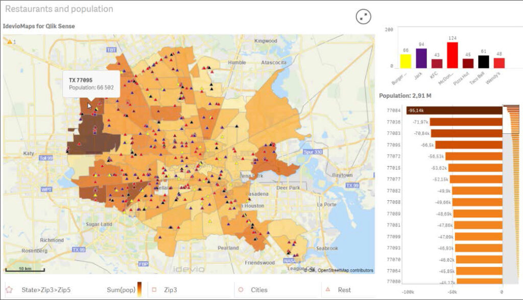
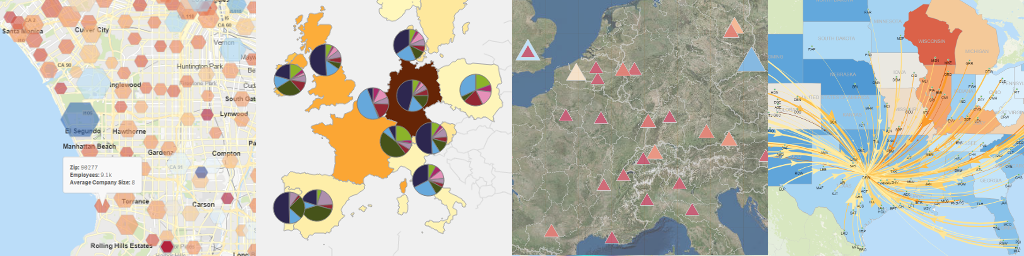
Qlik GeoAnalytics provides comprehensive mapping capabilities, allowing you to create intuitive, interactive maps. These maps can then be integrated into your Qlik Sense apps, providing a visual representation of geographical data that enhances understanding and drives insight.
Location-based Analytics
By enabling location-related data analyses, GeoAnalytics allows users to perform complex geographic operations without being a GIS expert. These might include calculating distances between locations, finding the nearest store or service point, or identifying geographical clusters of data.
Geocoding
Geocoding is a feature that converts addresses into geographic coordinates, which can then be used to place markers on a map. This feature enables you to transform location data such as country, city, or street address into visual map points, thus creating a more interactive and comprehensive view of your data.
Geo-enrichment
GeoAnalytics can enrich your data with a geographical dimension, even if it’s not initially present. For example, you can supplement your sales data with demographic data based on the sales location, helping you understand the relationship between your sales and local population characteristics.
Layered Visualizations
Layered visualizations allow you to display multiple data sets on a single map, enabling a more comprehensive view. You can use this to compare different geographical data sets, such as sales performance by region layered with demographic data.
Integration with Qlik Sense
GeoAnalytics is seamlessly integrated with Qlik Sense, meaning you can leverage the full suite of Qlik Sense tools while using GeoAnalytics. The combination of advanced BI tools with sophisticated geographic analysis provides a powerful platform for data-driven decision-making.
In conclusion, Qlik GeoAnalytics enriches your Qlik Sense applications with a comprehensive geographical perspective. Whether you’re analyzing sales, logistics, demographics, or any other location-related data, Qlik GeoAnalytics provides you with the tools to understand your data in the context of its geographical location.